About Tandulwadi Fort Trek
Tandulwadi Fort is located near Saphale, 104 km north of Mumbai. Tandulwadi is not a fully built up fort, but a series of structures spread over the top of the mountain. The fort dates back 800 years and was primarily used as a watch tower over the surrounding plains. At a height of 1524 feet, it has views of the surrounding towns of Saphale, the Zanzorli lake, and the confluence of the Surya and Vaitarna rivers.
The fort is located near Lalthane village in Palghar district, about 104 km from Mumbai, 75 km from Thane and 7.5 km from Saphale Railway station. It is also reachable through the Mumbai - Ahmedabad Highway NH 8. Upon reaching Varai Phata you have to take a left turn after crossing the bridge over Vaitarna river. A few minutes drive on this road and one can see the Tandulwadi fort on the front hillocks. Tandulwadi village is 15 km from the Varai Phata. There are no hotels or restaurants in the village except a few grocery shops. Tandulwadi village is well connected by road. Tandulwadi village is a small Varli tribal village
One Day Monsoon Trek To Tandulwadi Fort
My first visit to Tandulwadi fort was an experimental trek. Often hear about this trekking destination near Mumbai. As it was a new route and a new fort to conquer on a week day it was just two of us that set out. This was one winter morning we reached Saphale western railway line with the train service now extended till Dahanu those trekkers living along the western railway definitely have something to Cheer. As forts in Palghar and Saphale are now just a hop skip and jump. The train changing at Virar or taking the Surat passenger is history.
Time to Reach
Some of the books that I had referred to before we started this trek did mentioned a trek from the railway station till the village. Approximately around 90 minutes of walking. Tandulwadi is also the name of the base village. Maybe that is why it is called Tandulwadi fort. As we walked out from the station we had breakfast and took a auto rickshaw ride till the base village. On inquiring it was know that there are regular buses from Saphale railway station till Tandulwadi base village every one hour till 11:00 am. After that the frequency is every two hours mostly irregular.
The approach to the fort is after the houses from the main road where we got off the rickshaw. The best is to remember the local Gram Panchayat office. Follow the lane that take you into the village and you may meet some soma school kids playing hopscotch or a local village at the hand pump. Ask anyone and thou shall be guided to the right path.
Paths for Tandulwadi Fort Trek
There two known paths for Tandulwadi fort trek
- Left way steep – rating 5.5 on a scale of 10
- Right way medium steep – rating 5 on a scale of 10
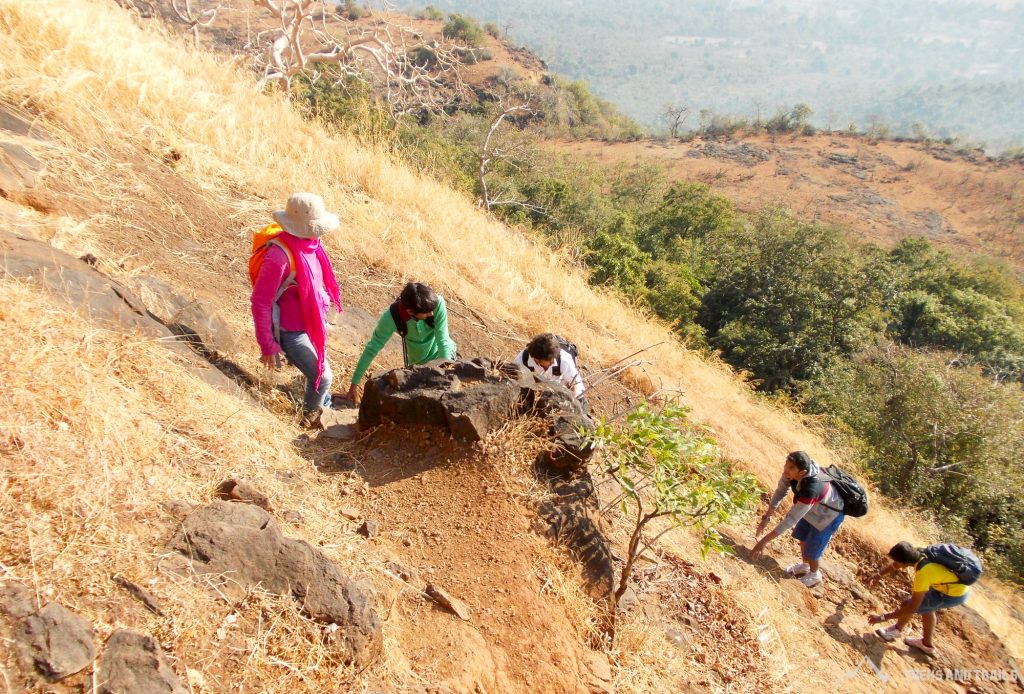
Left way is very simple and quick route as one reached the plateau keep the initial first mount to your left continue walking. A walking route is also visible from the plateau. We continue walking on the cattle trot gain height rather quickly. The view is simply awesome from your first halt we could see Saphale town and if I am not mistaken we could also see Palghar. Moving closer to summit we crossed an old water tank which is now completely destroyed. With boulders and mud now filled in the tank. Keeping the tank on our left hand side we continue walking and reach a Col. A group of 7 people can stand hear easily. We take a right from here and continue walking along the ridge. In the next 5 minutes we could see the last broken ruins of the fort wall.
Water Tank Cluster
Exploring the fort would take not more than 30 minutes as most of it is all in ruins. The famous seven water tank cluster is still visible. Lack of care has resulted in the tanks being in depleted state. While descending we decided to take the Right way route. We came upon another water tank. Exploring the area around we spotted two hidden water tanks from above. Opposite this dry water tank one can still seen a small section of the old fort wall. The descend route is not very well marked and seems not used often. We checked the hidden tanks, there was water is it that too in December. The water of these tanks is not portable. The route ends on a back of the huge plateau. Close to 8 minutes of walking is required on the plateau before we come upon the junction where the route on the left goes down to the village and the route on the right will take you back to Tandulwadi fort.
Treks and Trails disclaimer / Important Note for Tandulwadi fort trek.
Wild animal spotting possible. Wildflowers will offer you a grand welcome during monsoon. The above information should only be used as a reference. Treks and Trails suggest please check with experts and locals before embarking on a trek.
Tandulwadi fort Information
The Closest railway station is Saphale and the closest airport is Mumbai airport.Distance from Mumbai is 105 km & approx drive time is 2 hour and from Pune it is 235 km,approx drive time is 3.5 hours. There are combined Trek option Asherigad – Kohoj - Takamak (2 days and the Best time to visit the trek is July to January.For food availability it is advised to take pack lunch and plenty of water for one-day trek

